Connected to Major
Transportation Corridors
Convenient access to U.S. highways and interstate routes keeps Lowndes County Port connected to regional markets.
Efficient Regional Connections
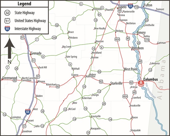
The Lowndes County Port is served by US Highway 82, an east-west four-laned route about two miles from the port, and US 45, a north-south, four-laned highway also two miles from the port.
The port’s east bank connects to Highways 82/45 via Port Access Road to Island Road to Main Street/182. The west connects to Highways 82/45 via Old Macon Road and Old Highway 82 West to 45 and 82.
The nearest interstates are I-22/78, north about 65 miles in Tupelo by way of US 45, and I-20/59, east via US 82, 65 miles in Tuscaloosa, Alabama.
Positioned for Distribution
Lowndes County Port’s location near U.S. 82 and U.S. 45 provides strong north-south and east-west access throughout Mississippi and into neighboring states.